Fig.1 Roadmap of South-to-North Water Diversion Project
December 2013 and December 2014 witnessed the successful completion of the first phase of the Eastern and Middle Routes of the South-to-North Water Transfer Project, events which attracted global attention and meant that Yangtze River has become a pivotal water source for central and eastern parts of China.
The natural conditions of water resources vary greatly between North and South China. The runoff of rivers in the Yangtze River Basin and its southern area accounts for more than 80% of the national total but it only has 35% of China’s cultivated land. Meanwhile, the runoff of rivers in the Huaihe, Haihe and Yellow River Basins in the North only accounts for 6% of the national total while the area has 40% of China’s cultivated land. This imbalance between water and land resources seriously affects China's economic development, and led Chairman Mao Zedong to propose the concept of South-to-North Water Diversion in 1952 when he visited the Yellow River.
After nearly half a century of work, and in line with analysis and comparison on more than 50 occasions, this scheme was finalized by diverting water from the lower, middle and upper reaches of the Yangtze River to different regions in the north with eastern, middle and western diversion routes. Through these three water diversion routes, the Yangtze River, Huaihe River, Yellow River and Haihe River are inter-connected, thus constituting the overall pattern of water resource distribution in central China: four horizontal rivers and three vertical canals, diversion from the south to the north, and mutual supplement between the east and the west.
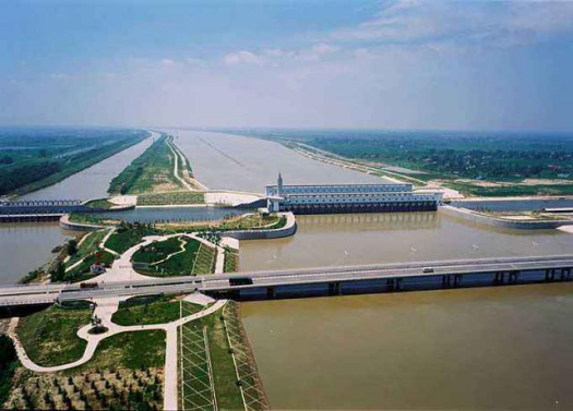
1. Eastern Route: Water diversion is gradually expanded in scale and length by utilizing the existing regional water transfer project in Jiangsu Province. The route draws water from the Yangtze River at Jiangdu, Yangzhou, in the lower reaches of the Yangtze River, and uses the ancient Beijing-Hangzhou Grand Canal and its parallel rivers to divert water to northern China through a series of pumping stations. This route links Hongze Lake, Luoma Lake, Nansi Lake and Dongping Lake, which regulate the water supply and store water. There are two ways to transport water from Dongping Lake: to the north, passing through the Yellow River via a siphon near Weishan and terminating at Tianjin; the other is to the east, travelling through the Jiaodong water transmission line to Yantai and Weihai. The main water diversion channel and the the first phase of the Eastern Route, with a length of 1466.50 km, was completed to supplement urban, industrial and environmental water use along the route, and also takes into account agricultural, navigation and other uses.
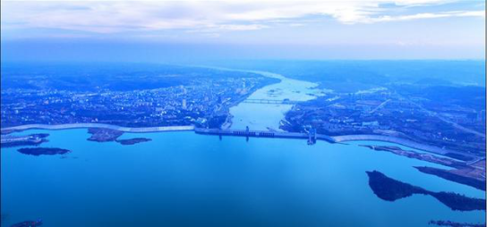
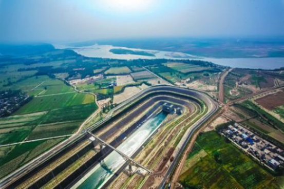
2. Middle Route: Through the newly-excavated channel along the route, water is diverted from Danjiankou Reservoir and passes through the watershed dividing the Yangtze and Huaihe River Basins at the western part of Tangbai River Basin. The route goes along the western edge of North China Plain and then crosses the Yellow River at Zhengzhou. The water then runs north along the western side of the Beijing-Guangzhou Railway before entering Beijing and Tianjin by gravity to meet the domestic, industrial, ecological and agricultural needs of 19 large and medium-sized cities, including Beijing and Tianjin, and more than 100 counties in the North China Plain. At present, the first phase of the Middle Route has realized water supply.

Fig.2 Jiangdu Pumping Station of the Eastern Route
3. Western Route: Water is transferred from the Yangtze River to Yellow River through dams and reservoirs built on the Tongtian River, Yalong River and Dadu River, and tributaries of Yangtze River, as well as by excavating tunnels through the Bayan Hara Mountain, the watershed between the Yangtze River and the Yellow River. This route is mainly aimed at addressing water scarcity in the upper and middle reaches of the Yellow River and the Guanzhong Plain. Construction of this route has yet to be launched.
Construction of the South-to-North Water Diversion Project will be completed in about 40-50 years. The completed project will be capable of transferring 44.8 billion m3 of water, 14.8 billion m3 of which from the Eastern Route, 13 billion m3 from the Central Route and 17 billion m3 from the Western Route.

Fig.3 Danjiangkou Reservoir

Fig.4 Project of Crossing the Yellow River in the Middle Route