Fig.1 Map of regional canals in the sixth century

Fig.2 Map of the Grand Canal in the Sui, Tang and Song Dynasties
(from the sixth to the 12th century)

Fig.3 Map of the Grand Canal in the Yuan, Ming and Qing dynasties
(from the 12th to the 19th century)
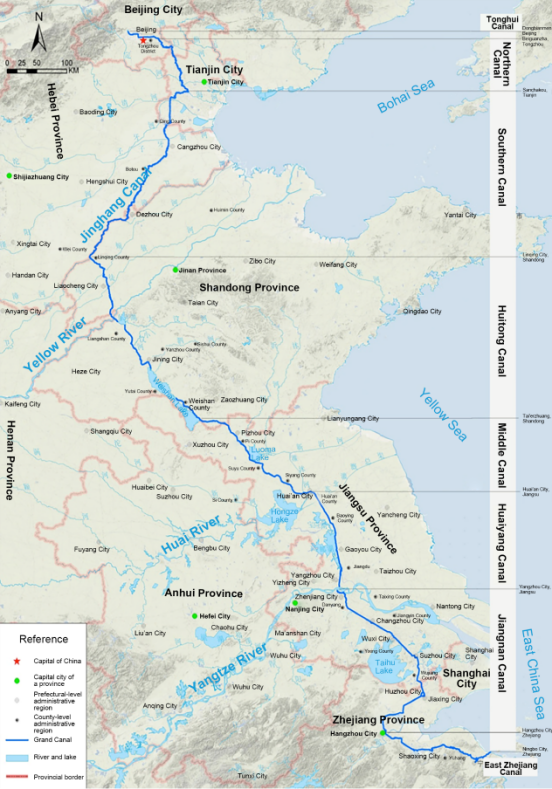
According to historical records, the Grand Canal of China has been in use for nearly 2,500 years, since the excavation of the Hangou Canal in 486 BC. It was added to the UNESCO World Heritage List in 2014 due to its exceptional historical, technological and cultural value.
Starting at Ningbo in Zhejiang Province, the Grand Canal extends northwards for a maximum of 2,000 kilometers before terminating at Beijing. The current length of the canal is 1,750 kilometers. The Grand Canal runs across China’s five river basins from the south to the north, linking the Qiantang River, the Yangtze River (Taihu Lake), the Huai River, the Yellow River and the Hai River, all of which generally flow from the west to the east. The greatest variation in altitude along the route of Grand Canal is 50 meters and the annual precipitation ranges from 500 to 1,400 millimeters.
The excavation of Grand Canal can be traced back to the Spring and Autumn and the Warring States Periods (770 to 221 BC). At that time, due to military needs, the warring states initiated the construction of some regional canals, connecting the Yangtze River and Taihu Lake, the Yangtze and the Huai rivers, the Huai and the Yellow rivers, and the Yellow and Hai rivers respectively (see pic.1). Based on these connections, the royal court in the Sui Dynasty (581 to 907 AD) ordered the excavation of the Tongji Canal and Yongji Canal and the rehabilitation of the Huaiyang Canal and the Jiangnan Canal, thereby forming a national Grand Canal system, with twin capital cities of Luoyang and Kaifeng at its center (see pic.2). This enabled the shipment of food grain from agricultural areas in the south to the northern part of the country. In Yuan Dynasty (13th century AD), China’s capital city was moved to Beijing. During this period, the curved route of Grand Canal formed in Sui Dynasty was straightened, and two new canals, the Huitong and Tonghui (see pic.3) were excavated and added to the system. As a result, the famous Beijing-Hangzhou Grand Canal system came into existence, and it remains well known to this day.
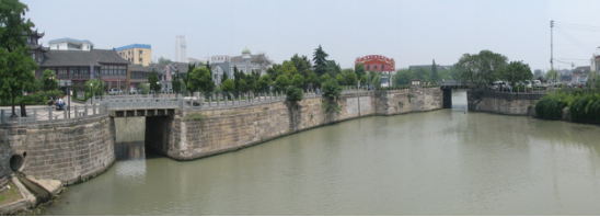
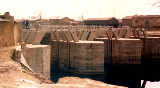
In order to facilitate the smooth functioning of the canal system, various water structures featuring regional characteristics, including sluices, dams and reservoirs, were built throughout different dynasties. These projects represent the cream of water science and technology innovation in Chinese history (see pics. 4 and 5). Before the 1900s, the Grand Canal not only served grain transportation, but also boosted the cultural exchanges between southern and northern China. Being an economic and cultural nexus, it has made important contributions to the nation’s social and economic development.

Fig.4 Sluice on the Grand Canal
(the Great Sluice of the Qing River,Huai’an City)

Fig.5 Sluice on the Grand Canal (the East Sluice of Cangzhou City)

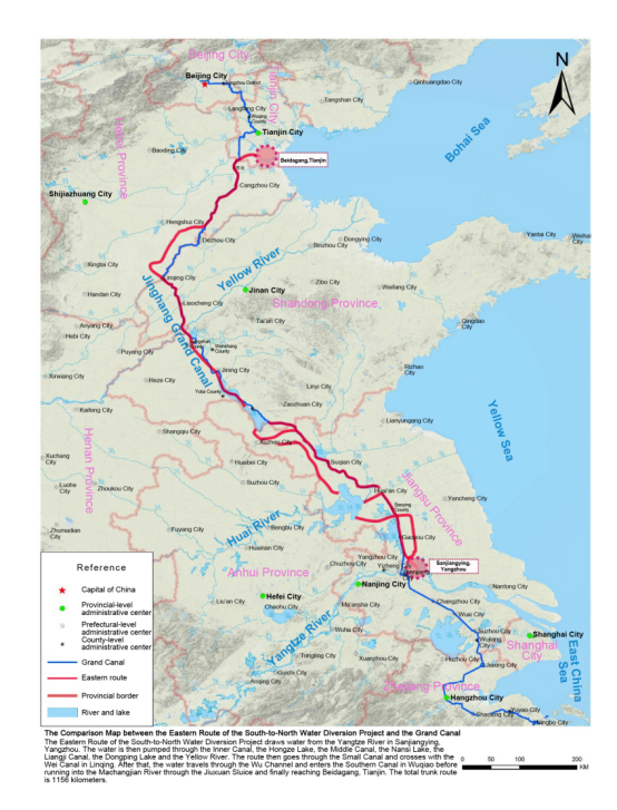
Fig.6 Comparison Map between the Eastern Route of the South-to-North Water Diversion Project and the Grand Canal